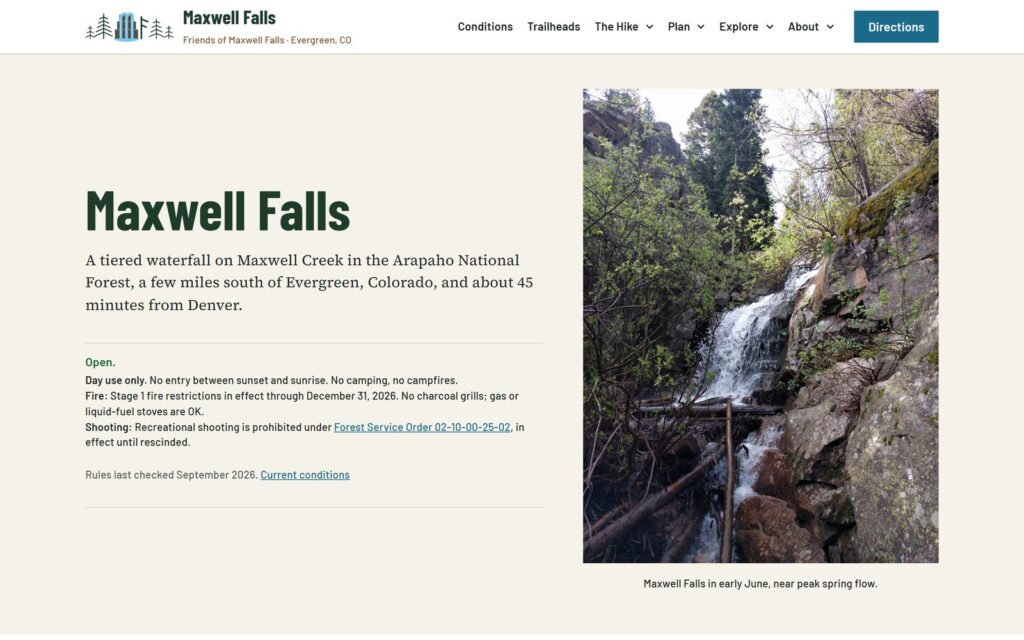
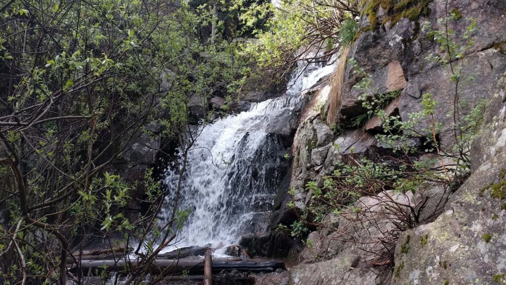
Maxwell Falls is just up the road from our Evergreen location, and this year its website got a fresh start.
Since 2017, Wild Iris Marketing has looked after maxwellfalls.com with two other local outfits, AlphaPixel and Evergroove Studio, under the name Friends of Maxwell Falls. In 2026 we rebuilt the site from scratch. Wild Iris designed it and hosts it, AlphaPixel measured the routes and made the maps, and Evergroove sponsors it. Chris Hanson from AlphaPixel explains why we do it:
I hike at Maxwell Falls multiple times a week and we are always aware of visitors at the trailheads. We see the issues and challenges visitors face and wanted to make sure they were armed with accurate and complete information because the Forest Service doesn’t have the resources to dedicate to this particular property.
Chris Hanson, AlphaPixel
We planned the new site the same way we plan a website for a business client. First we looked at what other trail and hiking sites offer. Then we asked what a visitor really needs to know before heading up Brook Forest Road. That turned out to be a lot! The site now covers three routes (Lower Maxwell Falls, the short hike to Upper Maxwell Falls and the Cliff Loop) with a page comparing them, a trail map with downloadable GPS tracks, directions and parking for both trailheads, conditions, rules, safety and Leave No Trace, what to expect each season, the area’s nature and history, photos, answers to common questions, and other hikes nearby.
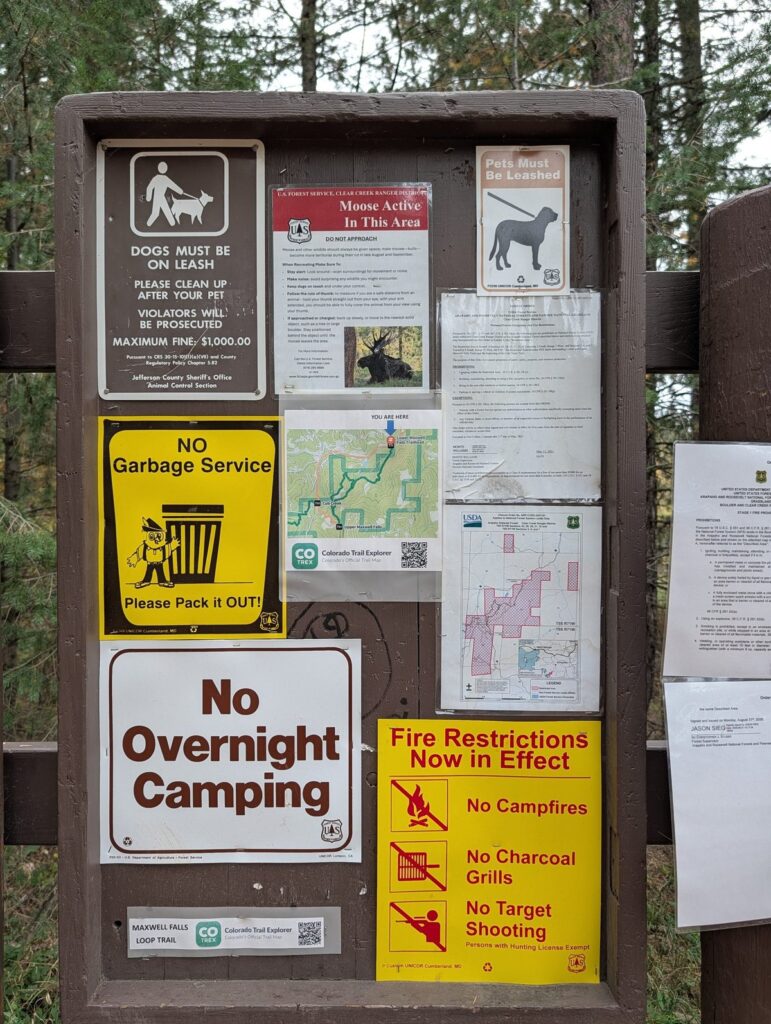
We thoroughly checked information in person. Old Forest Service pages call this Trail #111, but the posts at both trailheads say Trail No. 39, so the site says 39. We looked at the parking while we were there, too. The lower lot holds fewer than 18 cars, the overflow lot 15 to 20, and the upper trailhead about 15.
Published distances for the hike don’t all agree, so AlphaPixel measured every route the same way, from OpenStreetMap trail lines and USGS lidar elevation data. The site gives one consistent set of distances, climbs and elevation profiles, and you can save the maps and GPS tracks to your phone before you head up (the signal up there is spotty).
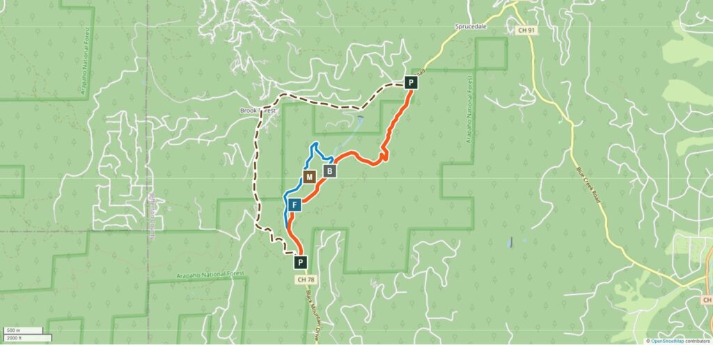
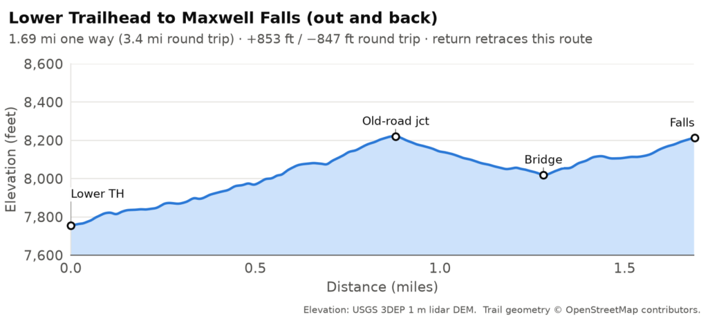
There’s also a heads-up we’d want on a first visit. On a map, the road between the two trailheads looks like a short walk. It’s longer than it looks, there’s no sidewalk or shoulder, and your phone may not have a signal.
We built the site with the same tools we use for our clients’ websites, so anyone on the team can update a rule or the conditions note in a few minutes, without calling a developer.
A company website and a trail guide do the same job. Someone has a question, and the site either answers it or sends them looking somewhere else. A hiker wants to know which trailhead to use, where to park and how long the hike really is. A customer wants your hours, your prices and what you can do for them. When the answers are accurate, up to date and easy to find, people arrive prepared, and they trust you before they’ve even met you.
Take a look at maxwellfalls.com before your next hike. And if your own website could use the same care, give us a call. The first consultation is free.